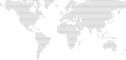
You can limit to one (or several) countries (France, Italy, UK)
## Installation
Requires NodeJS ≥ 13.
```bash
npm i dotted-map
```
## Usage
```js
const fs = require('fs');
const DottedMap = require('dotted-map');
const map = new DottedMap({ height: 100, grid: 'diagonal' });
const svgOptions = { color: '#d6ff79', radius: 0.22 };
map.addPin({ lat: 40.73061, lng: -73.935242, svgOptions });
map.addPin({ lat: -33.865143, lng: 151.2099, svgOptions });
map.addPin({ lat: -23.533773, lng: -46.62529, svgOptions });
map.addPin({ lat: 37.773972, lng: -122.431297, svgOptions });
map.addPin({ lat: 52.520008, lng: 13.404954, svgOptions });
map.addPin({ lat: 55.751244, lng: 37.618423, svgOptions });
map.addPin({ lat: 35.652832, lng: 139.839478, svgOptions });
map.addPin({ lat: 14.716677, lng: -17.467686, svgOptions });
map.addPin({ lat: -33.918861, lng: 18.4233, svgOptions });
map.addPin({ lat: -20.88231, lng: 55.4504, svgOptions });
map.addPin({ lat: 48.8534, lng: 2.3488, svgOptions: { color: '#fffcf2', radius: 0.4 } });
const svgMap = map.getSVG({ radius: 0.22, color: '#423B38', shape: 'circle', backgroundColor: '#020300' });
fs.writeFileSync('./map.svg', svgMap);
```
Note: if you use a large number of points (height or width ≥ 100), it may take a bit of time to compute the map (from 1 to 30 seconds depending on your device and number of points). This is why the result grid is cached. If you don't change the parameters of `new DottedMap`, the next maps will be a lot faster to generate. You can however change the pins and the SVG options.
## Specs
```js
// Create the map
const map = new DottedMap({
height,
width, // just specify either height or width, so the ratio of the map is correct
countries: ['FRA'] // look into `countries.geo.json` to see which keys to use. You can also omit this parameter and the whole world will be used
region: { lat: { min, max }, lng: { min, max } }, // if not present, it will fit the countries (and if no country is specified, the whole world)
grid: 'vertical' | 'diagonal', // how points should be aligned
});
// Add some points/change the color of existing points
map.addPin({
lat,
lng,
svgOptions: { color, radius },
data, // whatever you want, useful if you use the method `getPoints` to get the raw points
});
// If you want to get the raw array of points
map.getPoints();
// [{ x, y, data, svgOptions }]
// Or use this method to get a string which is a SVG
map.getSVG({
shape: 'circle' | 'hexagon', // if you use hexagon, prefer the grid `diagonal`
backgroundColor, // background color of the map
color, // default color of the points
radius: 0.5, // default radius of the points
});
//
```
## Acknowledgments
Countries are from https://github.com/johan/world.geo.json.